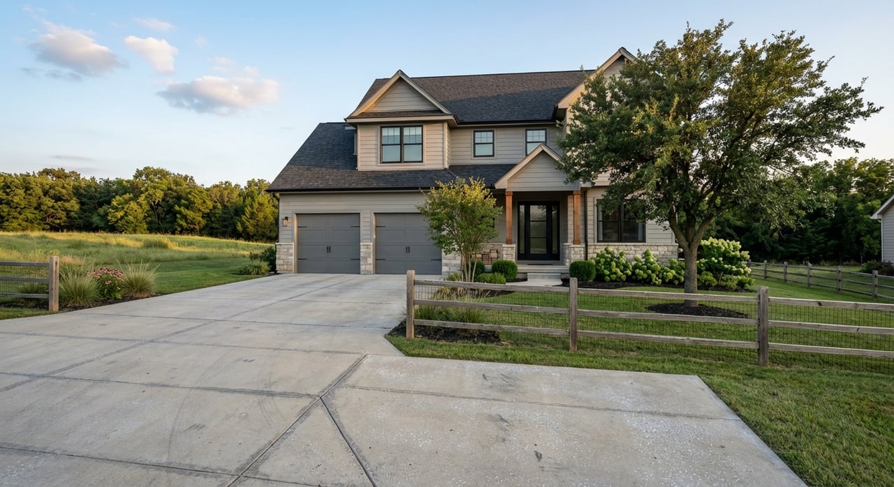
Dreaming about a little more elbow room without giving up Lenexa convenience? If you want 5–10 acres, you are competing for a limited set of parcels that sit where suburban neighborhoods meet open country. You want privacy and space, but you also need the right utilities, access, and zoning to make your plans work.
In this guide, you will learn exactly where to focus your search, what tradeoffs to expect, how to set smart alerts, and the due diligence that protects you before you write an offer. Let’s dive in.
Best areas near Lenexa for 5–10 acres
Finding 5–10 acre parcels close to Lenexa usually means targeting the transition zones along the southern and western edges of Johnson County. Here are the most productive corridors and what you should expect in each.
Southern Lenexa and northwest Olathe fringe
- Where to look: South of Lenexa city limits where Lenexa meets Olathe and unincorporated Johnson County.
- Why it works: You will find a mix of legacy family tracts, older rural residential parcels, and some undeveloped lots near recent growth. Commutes to Lenexa amenities are typically manageable.
- Utilities and access: Many parcels rely on private well and septic. Some sites near existing city limits may be close enough to connect to municipal water or sewer. Road access ranges from paved residential streets to gravel county roads.
- Zoning and annexation: Parcels may be under county agricultural or rural residential zoning today. Tracts that are contiguous to Olathe or Lenexa growth areas could be candidates for annexation over time. Review city annexation and comprehensive plans before you commit.
Spring Hill corridor toward Lenexa and Olathe
- Where to look: The corridor between Spring Hill and the southern edges of Lenexa and Olathe, including areas near K‑7 and US‑169.
- Why it works: This area has historically been agricultural, so 5–10 acre tracts still surface even as development moves north. Developers hold some land, but pockets remain for private buyers.
- Utilities and access: Expect private well and onsite wastewater. Extending municipal services can be costly, so verify proximity and policies early, especially near Spring Hill city limits.
- Zoning and land use: County agricultural or rural residential is common. Parcels near Spring Hill may come under city planning considerations in the future.
De Soto and Edgerton fringe
- Where to look: West and southwest of Lenexa toward De Soto and Edgerton.
- Why it works: You will see former farm tracts and rural parcels with lower density, which translates to more opportunities in the 5–10 acre range. Highway access can help commuters.
- Utilities and access: Largely rural. Plan for private utilities and confirm any nearby industrial zoning, especially near Edgerton, so you understand long‑term surroundings.
- Annexation factors: City growth patterns in De Soto or Edgerton can influence land use over time. Check city plans if you are near current boundaries.
Scattered pockets east of Lenexa
- Where to look: Smaller, less predictable pockets east of Lenexa in older rural residential areas.
- Why it works: Occasionally you will see long‑held estates or subdivided farm parcels hit the market.
- Notes: Parcels here are fragmented and may include restrictive covenants or conservation easements. Confirm any recorded limitations before you proceed.
Pro tip: If acreage is a must‑have, widen your radius to about 15–25 miles from Lenexa. Inventory improves as you move beyond the immediate suburban ring.
Key tradeoffs to expect
- Proximity vs. utilities: Closer‑in parcels often operate on private well and septic. Some farther parcels have better access to city utilities, but you will trade for a longer commute.
- Annexation risk: Land near city limits or in growth plans can be annexed later. That can bring services and different tax or zoning impacts.
- Site constraints: Floodplain edges, soil types, and access easements can affect buildability, costs, and timelines.
What to check before you buy
Buying acreage is equal parts lifestyle and technical due diligence. Use this checklist to confirm what matters most.
Zoning and allowed uses
- Identify the zoning district through Johnson County Planning and Zoning or the relevant city if inside city limits.
- Understand minimum lot sizes, accessory structures, and dwelling rules for your district.
- Confirm whether the parcel falls within a city’s growth or extraterritorial planning area, which can change future use or standards.
Annexation and timing
- Review annexation maps and comprehensive plans for Lenexa, Olathe, and Spring Hill if you are near their edges.
- Ask how annexation would impact utility connections, road obligations, and taxes.
Utilities and connections
- Water and sewer: Expect private wells and onsite wastewater outside city limits. Verify the distance to municipal water or sewer and the policy for extensions.
- Electric and gas: Contact local providers to confirm line proximity and potential extension costs.
- Broadband: Options vary on rural parcels. Confirm availability of fiber, cable, fixed wireless, or satellite service.
Septic and well requirements
- Onsite wastewater systems in Kansas follow KDHE standards, with additional county requirements possible.
- Plan for soils testing and, if necessary, a percolation test and engineered design before building.
- Review well logs or drilling feasibility if no well exists.
Road access and drive permits
- Confirm legal access and whether it is through deeded road frontage or an easement.
- Ask if the road is county maintained or private. Maintenance responsibility and costs vary.
- Check if you need a driveway permit where the drive meets a county or city road.
Floodplain, drainage, and soils
- Use FEMA flood maps to identify any floodplain impacts that limit building or septic placement.
- Review Johnson County floodplain data and drainage patterns on site. Look for low spots and seasonal flow paths.
- Consult soil data to understand septic suitability and potential foundation considerations.
Easements, leases, and rights
- Title records may show utility easements, conservation easements, farm leases, or mineral reservations.
- Active crop or pasture leases can affect possession and early use.
Taxes and assessments
- Check current property taxes and whether the parcel lies in any special improvement or utility district.
- Ask how annexation or rezoning could change the tax profile.
How to search and set smart alerts
Finding acreage is part strategy and part speed. Use multiple sources and configure alerts to capture new opportunities quickly.
Combine platforms
- Local MLS through a licensed broker is your most accurate and timely source for new listings and parcel data.
- Land‑specific portals can help filter for acreage, soils notes, and land attributes.
- County parcel and GIS tools let you verify parcel size, boundaries, and owner of record.
- A land‑savvy agent can surface off‑market leads and pocket listings you will not find elsewhere.
Use targeted filters and keywords
- Acreage: Set minimum to 5 acres and maximum to 10 acres.
- Property type: Choose land, farm, or lots and land. Exclude active construction subdivisions if you want raw or lightly improved land.
- Keywords: Try acreage, 5 acres, 10 acres, pasture, private well, no HOA.
- Radius: Start with 10–15 miles from Lenexa. Expand to 20–25 miles if inventory is thin.
Set alerts the right way
- Work with your agent to create saved searches in the local MLS with acreage, location polygons, and utility or zoning fields where available.
- On consumer and land portals, save your search, enable email and push alerts, and watch for price changes and back‑on‑market status.
- Use county tools to monitor plats and ownership changes if that option is offered.
- For off‑market leads, ask your agent to track estate sales, farm auctions, and probate filings, and to reach out to nearby owners when you find a promising corridor.
Map smarter
- Draw custom polygons that trace the southern Lenexa and northwest Olathe fringe, the Spring Hill corridor, and the De Soto and Edgerton edges.
- Bookmark parcels in the county GIS viewer so you can cross‑check legal lines when a new alert arrives.
- Compare alerts to floodplain layers and roads to quickly rule parcels in or out.
Site visits and pre‑offer due diligence
Use this field checklist as you tour properties and before you write an offer.
- Confirm parcel boundaries and acreage with county GIS and the recorded plat.
- Verify zoning, setbacks, and any overlay districts or floodplain.
- Order a preliminary title commitment to identify easements, conservation restrictions, and mineral rights.
- Arrange soils and septic evaluations and, if needed, a percolation test.
- Request utility proximity checks from the city or county and from service providers for water, sewer, electric, gas, and broadband.
- Review any building permit history and code issues.
- Drive the area at different times of day to evaluate traffic, noise, drainage, and access.
- Commission a survey if boundaries are unclear or if required by your lender.
- If financing, confirm land loan terms early. Down payments and reserves can differ from a traditional home mortgage.
- Review current taxes and any special assessments or district fees.
Putting it together
Your best odds of finding 5–10 acres near Lenexa come from a focused search in the southern and southwestern fringe, including the Olathe edge, the Spring Hill corridor, and the De Soto and Edgerton area. Expect private well and septic, verify access and zoning early, and build a due diligence plan around floodplain, soils, utilities, and annexation.
If you want a partner who understands both the lifestyle and the technical side of land, connect with a local specialist who lives the acreage life and brings engineering‑level rigor to wells, septic, easements, and surveys. When you are ready to explore parcels or set up high‑signal alerts tailored to your goals, reach out to Jamie Howell for a free consultation.
FAQs
What utilities should I expect on 5–10 acre parcels near Lenexa?
- Outside city limits, most acreage relies on private wells and onsite wastewater systems. Municipal water or sewer may be possible only if lines are nearby and policies allow connections or extensions.
Can I build right away on a newly purchased 5–10 acre lot in Johnson County?
- Often yes for a single‑family residence if zoning allows and soils support septic, but permits for septic and driveway access, plus any needed variances, can add time.
How big is the annexation risk for land near Lenexa and Olathe?
- Parcels that touch current city limits or sit inside city growth corridors have higher annexation potential. Reviewing city annexation and comprehensive plans is essential.
How do I find off‑market 5–10 acre opportunities around Lenexa?
- Work with a land‑focused agent who monitors county records, farm auctions, and estate sales, and who can contact owners of record on adjacent parcels.
What are the main tradeoffs when buying acreage close to Lenexa?
- You will balance commute convenience against utility access. Closer parcels often need well and septic, while some farther parcels may be nearer to city utilities but increase drive time.